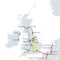
Category:High speed rail in the United Kingdom maps
Jump to navigation
Jump to search
Subcategories
This category has the following 2 subcategories, out of 2 total.
H
- High Speed 1 maps (10 F)
- High Speed 2 maps (26 F)
Media in category "High speed rail in the United Kingdom maps"
The following 18 files are in this category, out of 18 total.
-
East Anglia route map.png 442 × 445; 100 KB
-
Eurostar Group Network Map Oct 2023.png 2,520 × 2,250; 671 KB
-
High Speed Railroad Map of the United Kingdom.svg 1,120 × 1,120; 477 KB
-
HS2 vector map.jpg 1,738 × 1,587; 224 KB
-
HS3-2017-map.png 2,157 × 1,440; 3.51 MB
-
HS4Air.png 1,118 × 700; 764 KB
-
HSUK Wales.png 445 × 545; 130 KB
-
Infrastructure Diagram.png 431 × 396; 94 KB
-
Midlands Services Diagram.png 447 × 407; 135 KB
-
Night Map.png 515 × 558; 21 KB
-
North East Infrastructure Diagram.png 399 × 483; 108 KB
-
North West England.png 362 × 443; 161 KB
-
Scotland Infrastructure Diagram.png 384 × 485; 56 KB
-
Scotland Services Diagram.png 439 × 558; 132 KB
-
Services Diagram.png 455 × 554; 182 KB
-
South East England Infrastructure Diagram.png 438 × 327; 73 KB
-
South East England Services Diagram.png 433 × 329; 73 KB
-
South West England route map.png 451 × 323; 69 KB


