Category:Maps of England
Jump to navigation
Jump to search
Constituent countries of the United Kingdom: England · Northern Ireland · Scotland · Wales – British Crown dependencies: Bailiwick of Guernsey · Isle of Man · Jersey
British overseas territories: Akrotiri and Dhekelia · Anguilla · Bermuda · British Antarctic Territory · British Indian Ocean Territory · British Virgin Islands · Cayman Islands · Falkland Islands · Gibraltar · Pitcairn Islands · Saint Helena, Ascension and Tristan da Cunha · South Georgia and the South Sandwich Islands · Turks and Caicos Islands
British overseas territories: Akrotiri and Dhekelia · Anguilla · Bermuda · British Antarctic Territory · British Indian Ocean Territory · British Virgin Islands · Cayman Islands · Falkland Islands · Gibraltar · Pitcairn Islands · Saint Helena, Ascension and Tristan da Cunha · South Georgia and the South Sandwich Islands · Turks and Caicos Islands
Wikimedia category | |||||
| Upload media | |||||
| Instance of | |||||
|---|---|---|---|---|---|
| Category combines topics | |||||
 | |||||
Subcategories
This category has the following 38 subcategories, out of 38 total.
- Toponymic maps of England (4 F)
*
A
B
C
- Maps of the Channel Tunnel (45 F)
E
F
- Flag maps of England (14 F)
G
- GDP maps of England (27 F)
H
L
M
- Maps of River Trent (28 F)
- Maps of Sandwich, Kent (4 F)
- Maps of Solway Firth (17 F)
- Military maps of England (3 F)
N
- NUTS maps of England (47 F)
O
P
R
S
T
Pages in category "Maps of England"
The following 2 pages are in this category, out of 2 total.
Media in category "Maps of England"
The following 57 files are in this category, out of 57 total.
-
 Gothic brick in England.png 2,103 × 2,547; 1,011 KB
-
 002osd000000002u00096000.jpg 4,000 × 3,060; 5.33 MB
-
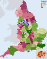
 2011 RUCLAD Assignments England.jpg 1,078 × 1,579; 436 KB
-
 2011 Rural Urban classification by census Output Areas in England.jpg 1,080 × 1,920; 602 KB
-
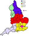
 2011 Rural Urban classification by Local Authorities in England 01.jpg 1,080 × 1,920; 397 KB
-
 Afghan population centres UK.svg 1,108 × 1,345; 366 KB
-
.jpg/120px-After_Action_Report_-_Dresden_-_NARA_-_100384478_(page_2).jpg) After Action Report - Dresden - NARA - 100384478 (page 2).jpg 10,562 × 7,652; 16.84 MB
After Action Report - Dresden - NARA - 100384478 (page 2).jpg 10,562 × 7,652; 16.84 MB
-
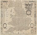 Angliae totius tabula 1677-1692.jpg 24,241 × 22,737; 476.87 MB
-
 Area di influenza della NUWSS.png 542 × 692; 688 KB
-
 Asser map.png 1,188 × 612; 452 KB
-
 Born Outside England 2011 Census.png 15,371 × 17,493; 43.91 MB
-
 BRITAIN INTO EUROPE 2.jpg 1,482 × 727; 546 KB
-
 Buss Distribution England.png 1,383 × 1,383; 348 KB
-
 Coal mining in England by county.jpg 533 × 607; 73 KB
-
 County tops.jpg 1,932 × 2,345; 512 KB
-
 ENG-southeast.png 480 × 400; 68 KB
-
.svg/120px-England_(orthographic_projection).svg.png) England (orthographic projection).svg 792 × 792; 2.95 MB
England (orthographic projection).svg 792 × 792; 2.95 MB
-
 England and Wales population cartogram districts.svg 1,022 × 1,166; 805 KB
-
 England and Wales population cartogram.svg 1,006 × 1,187; 737 KB
-
.jpg/98px-England_counties_population_(crop).jpg) England counties population (crop).jpg 1,083 × 1,321; 127 KB
England counties population (crop).jpg 1,083 × 1,321; 127 KB
-
.png/98px-England_counties_population_(crop).png) England counties population (crop).png 1,083 × 1,321; 181 KB
England counties population (crop).png 1,083 × 1,321; 181 KB
-
.png/98px-England_counties_population-ar_(crop).png) England counties population-ar (crop).png 491 × 599; 115 KB
England counties population-ar (crop).png 491 × 599; 115 KB
-
 England COVID-19 step levels by district.svg 512 × 621; 257 KB
-
 England Districts by Populatin Map 2.pdf 1,275 × 1,650; 2.76 MB
-
 England hill regions.jpg 1,180 × 1,428; 475 KB
-
 England Local Government Map.png 5,250 × 6,600; 4.52 MB
-
 England midlands as census.jpg 2,165 × 2,670; 508 KB
-
 England south of the humber and east of the isle of wight.png 164 × 240; 4 KB
-
 EnglandPopulation2011.png 440 × 510; 231 KB
-
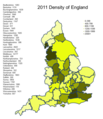 EnglandPopulationDensity2011.png 440 × 510; 241 KB
-
 English Districts by Population Map.pdf 1,275 × 1,650; 2.77 MB
-
 English Education Investment Areas 2022.png 687 × 839; 263 KB
-
 English North-South divide.png 2,140 × 2,645; 145 KB
-
 Genetic structure in England.png 1,632 × 2,016; 403 KB
-
 Gotischer Backstein Nordsee & westl. Ostsee.png 3,173 × 2,243; 6.94 MB
-
 HonourofAlbemarle.png 301 × 355; 15 KB
-
 M1 base.png 912 × 639; 418 KB
-
 M1 hard shoulder.png 943 × 664; 445 KB
-
 Map of Northumbria in England.svg 809 × 1,025; 933 KB
-
 Map of the Rate-Capping Rebellion.svg 698 × 796; 3.32 MB
-
 Map of Torquay, 1795.jpg 591 × 624; 35 KB
-
 Map Showing the Territory of the Forest of Arden.jpg 844 × 746; 248 KB
-
 N England slope map 50 m.png 7,399 × 7,963; 28.07 MB
-
 Nordsee EN-B-DK.png 3,742 × 2,503; 1.7 MB
-
 North Midlands, General District & County Map as of 2013.png 645 × 318; 12 KB
-
_in_the_English_Middle_Ages.png/103px-Northern_England_(county_names)_in_the_English_Middle_Ages.png) Northern England (county names) in the English Middle Ages.png 596 × 692; 83 KB
Northern England (county names) in the English Middle Ages.png 596 × 692; 83 KB
-
 Reading GreaterLondon.png 516 × 457; 256 KB
-
 Rutland districts 1971.gif 1,640 × 1,503; 19 KB
-
 Surrey local government 1961-1971.png 1,837 × 1,357; 68 KB
-
 Teees Valley Map.png 516 × 400; 61 KB
-
 The Downs map.jpg 1,355 × 1,020; 492 KB
-
 The Metropolitan Green Belt among the green belts of England.svg 420 × 485; 357 KB
-
 Threefold division of England circa 1115.jpg 640 × 663; 65 KB
-
 Tolkien and Shakespeare Warwickshire.svg 677 × 531; 460 KB
-
 Wales, Central and S England slope map 50 m.png 14,873 × 11,310; 69.81 MB
-
 イギリス屋外野宿者数.png 642 × 787; 148 KB
-
 英超0809分布改圖.png 370 × 422; 22 KB


.jpg)


.svg)


.jpg)
.png)
.png)


_in_the_English_Middle_Ages.png)


