Category:Maps of the Great Western Railway
Jump to navigation
Jump to search
Subcategories
This category has only the following subcategory.
R
Media in category "Maps of the Great Western Railway"
The following 24 files are in this category, out of 24 total.
-
Cheffin's Map - Route of Great Western Railway, 1850.jpg 1,351 × 819; 373 KB
-
Cheltenham Flyer Map.png 6,213 × 2,737; 4.87 MB
-
Cogload Junction area.png 800 × 530; 43 KB
-
GWR main line cut off routes.png 960 × 480; 66 KB
-
GWR map Cornwall.jpg 1,011 × 768; 353 KB
-
GWR map Devon.jpg 768 × 837; 353 KB
-
GWR map shipping routes and docks.png 960 × 720; 72 KB
-
GWR map Somerset.jpg 960 × 768; 353 KB
-
GWR map.jpg 1,305 × 1,035; 600 KB
-
Llangurig railway extent 1866.jpg 355 × 221; 70 KB
-
Map of Great Western Railway 1920.jpg 2,783 × 1,785; 2.68 MB
-
Map of Great Western Railway 1926.jpg 2,440 × 1,869; 2.3 MB
-
South Somerset branch lines.png 760 × 580; 57 KB
-
Tn to Yeo 1853.gif 1,000 × 534; 31 KB
-
Truro 1859.gif 359 × 351; 14 KB
-
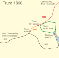
Truro 1860.gif 359 × 351; 14 KB
-
Truro 1863.gif 359 × 351; 16 KB
-
Truro road 1852 - 1863 mark 2.gif 359 × 351; 16 KB
-
Truro road 1852 - 1863.gif 359 × 351; 16 KB
-
West Cornwall Rly 1852.gif 1,492 × 848; 58 KB
_p.164_-_Great_Western_Railway_-_London_to_Bath_and_Bristol_(top)_-_A_+_C_Black_(pub).jpg/120px-EW(1884)_p.164_-_Great_Western_Railway_-_London_to_Bath_and_Bristol_(top)_-_A_+_C_Black_(pub).jpg)
_p.165_-_Great_Western_Railway_-_London_to_Bath_and_Bristol_(bottom)_-_A_+_C_Black_(pub).jpg/120px-EW(1884)_p.165_-_Great_Western_Railway_-_London_to_Bath_and_Bristol_(bottom)_-_A_+_C_Black_(pub).jpg)
_p.196_-_Great_Western_and_South_Devon_Railways_-_Bristol_to_Exeter_and_Plymouth_(top)_-_A_+_C_Black_(pub).jpg/120px-EW(1884)_p.196_-_Great_Western_and_South_Devon_Railways_-_Bristol_to_Exeter_and_Plymouth_(top)_-_A_+_C_Black_(pub).jpg)
_p.197_-_Great_Western_and_South_Devon_Railways_-_Bristol_to_Exeter_and_Plymouth_(bottom)_-_A_+_C_Black_(pub).jpg/120px-EW(1884)_p.197_-_Great_Western_and_South_Devon_Railways_-_Bristol_to_Exeter_and_Plymouth_(bottom)_-_A_+_C_Black_(pub).jpg)


