Category:Merseyrail maps
Jump to navigation
Jump to search
Maps of the services of the Train Operating Company Merseyrail.
Media in category "Merseyrail maps"
The following 21 files are in this category, out of 21 total.
-
 Allerton & Garston. Pateley Bridge Cleobury Mortimer RJD 158.jpg 2,667 × 1,625; 778 KB
-
 Bidston, Birkenhead & Rock Ferry RJD 74.jpg 2,718 × 1,890; 1.1 MB
-
 Garstang & Catterall, West Kirby Nantybwch, Rhymney, Rhymney Bridge RJD 110.jpg 2,697 × 1,697; 588 KB
-
 Hartford, Northwich and Rainford RJD 92.jpg 2,712 × 1,691; 562 KB
-
 Liverpool James Street Layout.jpg 291 × 290; 23 KB
-
 Liverpool rail lines in 1977.svg 941 × 631; 492 KB
-
 Liverpool RJD 42.jpg 1,245 × 1,897; 1.53 MB
-
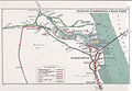
 Merseyrail Development.jpg 717 × 960; 188 KB
-
 Merseyrail map 2010.svg 1,226 × 1,334; 735 KB
-
 Merseyrail Map.svg 740 × 660; 673 KB
-
 Merseyrail Northern Line.png 600 × 836; 73 KB
-
 Merseyrail Wirral Line.png 742 × 1,066; 56 KB
-
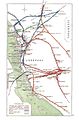
 Merseyrail30yearplan.png 7,016 × 4,961; 1.01 MB
-
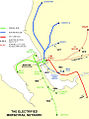
 Merseyrailnetworkmap.png 1,582 × 1,000; 213 KB
-
 MerseyRailPlus.svg 1,052 × 744; 347 KB
-
 MerseyrailPlusPlus.svg 1,052 × 744; 437 KB
-
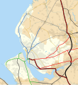
 Merseyside and Greater Manchester Railways.svg 1,734 × 709; 972 KB
-
 North Wales Rail.png 3,300 × 2,640; 1.38 MB
-
.png/103px-Northern_line_(Merseyrail).png) Northern line (Merseyrail).png 2,353 × 2,730; 2.96 MB
Northern line (Merseyrail).png 2,353 × 2,730; 2.96 MB
-
 Wirral Line map at Lime Street.jpg 1,600 × 1,200; 849 KB
-
 Wirral line.png 2,721 × 2,260; 3.64 MB


.png)

