Category:Rail transport maps of Buckinghamshire
Jump to navigation
Jump to search
Media in category "Rail transport maps of Buckinghamshire"
The following 27 files are in this category, out of 27 total.
-
London–Aylesbury line.png 2,357 × 1,686; 3.52 MB
-
Marlow branch line.png 1,498 × 1,838; 1.47 MB
-
1888 Rickmansworth-Aylesbury scheme.png 1,053 × 745; 182 KB
-
Aylesbury-Princes Risborough line.png 996 × 1,166; 653 KB
-
Brill area railway diagram 1872.png 1,000 × 1,000; 109 KB
-
Brill area railway diagram 1894.png 1,000 × 1,000; 127 KB
-
Brill area railway diagram 1910.png 1,000 × 1,000; 182 KB
-
Brill tramway system diagram.png 1,052 × 744; 79 KB
-
Brill tramway system diagram.svg 1,052 × 744; 48 KB
-
Buckinghamshire railways 2000.png 1,053 × 745; 166 KB
-
Buckinghamshire railways, 1880.png 1,053 × 745; 171 KB
-
Central Buckinghamshire railways, 1906.png 1,053 × 745; 208 KB
-
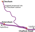
Chesham, Amersham and Chalfont stations, 1892.png 1,000 × 910; 69 KB
-
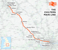
Chiltern Main Line map.png 866 × 761; 114 KB
-
Chiltern Main Line map.svg 866 × 772; 16 KB
-
Chiltern Main Line.png 2,098 × 1,822; 4.17 MB
-
East West Rail Consortium Central map.jpg 731 × 482; 37 KB
-
East West Rail Consortium Eastern map.jpg 618 × 463; 43 KB
-
East West Rail Consortium Western map.jpg 1,280 × 800; 154 KB
-
East West Rail Link Stansted Option.jpg 766 × 512; 31 KB
-
East West Rail services Diagram map.png 1,069 × 734; 89 KB
-
First Quainton Road station layout.png 745 × 670; 67 KB
-
First Quainton Road station layout.svg 744 × 670; 11 KB
-
Marston Vale line.png 2,186 × 1,946; 2.74 MB
-
Metro-land-map.jpg 1,507 × 1,200; 2.25 MB
-
MR Rickmansworth-Chesham-LNWR extension scheme.png 1,053 × 745; 179 KB
-
Waddesdon stations, 1903.png 680 × 501; 654 KB


