Category:Rail transport maps of Cambridgeshire
Jump to navigation
Jump to search
Media in category "Rail transport maps of Cambridgeshire"
The following 24 files are in this category, out of 24 total.
-
B'ham-Peterborough Line Map.png 1,324 × 527; 954 KB
-
Birmingham–Peterborough line.png 2,647 × 1,485; 3.17 MB
-
Breckland line.png 2,424 × 1,633; 2.82 MB
-
Cambridge line.png 1,422 × 1,325; 1.32 MB
-
East West Rail Consortium Eastern map.jpg 618 × 463; 43 KB
-
East West Rail Consortium overview map.jpg 1,024 × 768; 107 KB
-
East West Rail Consortium Western map.jpg 1,280 × 800; 154 KB
-
East West Rail Link Stansted Option.jpg 766 × 512; 31 KB
-
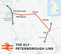
Ely-Peterborough line.png 1,534 × 1,370; 1.12 MB
-
Ely-st-ives1.png 1,538 × 753; 70 KB
-
Ely-st-ives2.png 1,538 × 753; 73 KB
-
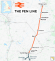
Fen line.png 1,739 × 1,900; 2 MB
-
Ipswich-Ely line.png 2,207 × 1,426; 2.14 MB
-
Kettering-huntingdon.png 1,529 × 658; 54 KB
-
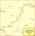
L&br-pbo-rly.png 1,073 × 1,110; 73 KB
-
Map-ElyUKRailwayJunctions.jpg 548 × 600; 43 KB
-
Mildenhall.png 1,535 × 1,015; 92 KB
-
Peterborough–Lincoln line.png 1,454 × 2,256; 1.62 MB
-
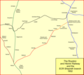
Royston & hitchin.png 1,208 × 1,075; 73 KB
-
Syston - Peterborough 1846.png 1,587 × 826; 85 KB
-
Syston to Peterborough 1848.png 1,587 × 826; 93 KB
-
Syston to Peterborough1893.png 1,587 × 826; 153 KB
-
Syston to Peterbrough 1879.png 1,587 × 826; 145 KB
-
West Anglia Main Line.png 1,594 × 2,375; 3.35 MB


