Category:Rail transport maps of Cheshire
Jump to navigation
Jump to search
Media in category "Rail transport maps of Cheshire"
The following 19 files are in this category, out of 19 total.
-
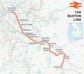
Buxton line.png 1,898 × 1,684; 2.18 MB
-
Chester & Birk 1840.png 1,492 × 1,086; 89 KB
-
Chester & Birk 1850.png 1,492 × 1,086; 113 KB
-
Chester & Birk 1866.png 1,492 × 1,086; 126 KB
-
Chester & Birk 1886.png 1,492 × 1,086; 164 KB
-
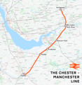
Chester-Manchester line.png 1,707 × 1,747; 2.31 MB
-
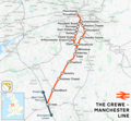
Crewe-Manchester line.png 1,632 × 1,503; 2.08 MB
-
Crewe–Derby line.png 2,025 × 1,481; 2.22 MB
-
Hooton–Helsby line.png 1,271 × 1,401; 1.37 MB
-
Liverpool–Manchester lines.png 2,501 × 1,575; 3.39 MB
-
Map of rail routes between Liverpool and Manchester in 1960.svg 702 × 318; 1.33 MB
-
Mid-Cheshire Line map.png 1,156 × 744; 600 KB
-
Mid-Cheshire line.png 10,490 × 6,848; 27.45 MB
-
North Wales Main line Map.png 7,000 × 2,000; 5.42 MB
-
Shrewsbury to Chester line Map.png 2,106 × 3,500; 3.75 MB
-
Stafford–Manchester line.png 1,546 × 1,868; 2.31 MB
-
Styal line.png 3,950 × 3,842; 7.25 MB
-
Welsh Marches line.png 2,112 × 2,297; 4.98 MB
-
Wirral rly.png 1,517 × 1,088; 93 KB


