Category:Rail transport maps of Cornwall
Jump to navigation
Jump to search
Media in category "Rail transport maps of Cornwall"
The following 30 files are in this category, out of 30 total.
-
Atlantic Coast Line.png 3,123 × 1,855; 2.84 MB
-
Bodmin & Wadebridge 1923.png 3,419 × 2,119; 146 KB
-
Cornish Main Line.png 2,600 × 1,595; 1.19 MB
-
Cornwall Rly original stations.png 2,111 × 1,363; 114 KB
-
Cornwall Rly stations.png 2,822 × 1,819; 170 KB
-
CornwallOldRailwayMap.png 1,100 × 939; 60 KB
-
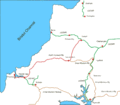
CornwallRailwayMap.png 1,100 × 904; 39 KB
-
Cruchley's Railway Map of Cornwall.jpg 2,336 × 1,650; 3.56 MB
-
GWR map Cornwall.jpg 1,011 × 768; 353 KB
-
Hayle Railway 1843.gif 671 × 553; 23 KB
-
Hayle Rly 1837 for wiki.gif 1,492 × 848; 53 KB
-
Hayle Rly.png 1,006 × 657; 43 KB
-
Helston in Cornwall Railways.gif 1,315 × 1,281; 119 KB
-
Looe Valley Line.png 1,091 × 1,410; 842 KB
-
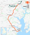
Maritime Line.png 1,402 × 1,633; 1.3 MB
-
NCRmap2.gif 600 × 377; 14 KB
-
ND&CJLR small.jpg 287 × 413; 19 KB
-
North cornwall railway map 1899.gif 1,400 × 1,229; 51 KB
-
Pentewan rly map.gif 3,361 × 4,432; 262 KB
-
St Germans deviation and Plymouth.gif 1,791 × 822; 98 KB
-
St Ives Bay Line.png 1,357 × 1,351; 612 KB
-
System map of Hayle Rly Cornwall in 1837.gif 6,693 × 3,793; 445 KB
-
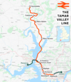
Tamar Valley Line.png 1,578 × 1,812; 1.79 MB
-
Truro 1859.gif 359 × 351; 14 KB
-
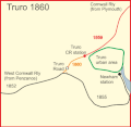
Truro 1860.gif 359 × 351; 14 KB
-
Truro 1863.gif 359 × 351; 16 KB
-
Truro road 1852 - 1863 mark 2.gif 359 × 351; 16 KB
-
Truro road 1852 - 1863.gif 359 × 351; 16 KB
-
West Cornwall Rly 1852.gif 1,492 × 848; 58 KB
-
West Cornwall Rly 2012.gif 1,606 × 910; 79 KB


