Category:Rail transport maps of Derbyshire
Jump to navigation
Jump to search
Media in category "Rail transport maps of Derbyshire"
The following 31 files are in this category, out of 31 total.
-
Ambergate junction.jpg 600 × 549; 107 KB
-
Ashton-under-Lyne.png 1,540 × 586; 68 KB
-
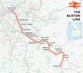
Buxton line.png 1,898 × 1,684; 2.18 MB
-
Buxton line.svg 1,207 × 1,107; 4.66 MB
-
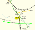
Chapel Milton Viaduct.svg 1,034 × 879; 1.26 MB
-
Crewe–Derby line.png 2,025 × 1,481; 2.22 MB
-
Derby station.svg 796 × 502; 579 KB
-
Derbyshire ext.png 1,395 × 1,066; 145 KB
-
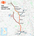
Derwent Valley line.png 1,760 × 1,868; 2.17 MB
-
Glossop line.png 2,023 × 1,202; 2.37 MB
-
Glossop Line.svg 1,207 × 543; 4.6 MB
-
Glossop Tramways.svg 1,713 × 1,648; 348 KB
-
Great Rocks Line.png 1,264 × 1,748; 770 KB
-
Hope Valley Line map.png 1,229 × 584; 791 KB
-
Hope Valley Line.png 3,052 × 1,886; 4.09 MB
-
Hope Valley Line.svg 1,152 × 547; 1.86 MB
-
Map of Buxton's Limestone Quarries.jpg 801 × 1,338; 96 KB
-
Mcrmap.jpg 400 × 886; 31 KB
-
Midland Railway Ilkeston.jpg 300 × 412; 24 KB
-
Nmrmap.jpg 400 × 1,183; 72 KB
-
North Midland Railway (connectivity map, 2008).jpg 400 × 1,183; 73 KB
-
Peak Forest Tramway.svg 1,887 × 1,394; 26.79 MB
-
Peak rail.jpg 600 × 747; 52 KB
-
Pinxton 1819.png 1,337 × 1,069; 50 KB
-
Pinxton 1851.png 1,337 × 1,069; 65 KB
-
Pinxton.png 1,337 × 1,069; 42 KB
-
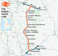
Robin Hood Line.png 1,486 × 1,439; 1.74 MB
-
Steeple Grange Light Railway plan.png 600 × 250; 7 KB
-
Trent junction.jpg 400 × 1,780; 71 KB
-
Woodhead line.png 2,994 × 1,739; 4.07 MB


.jpg/115px-Manchester%2C_Buxton%2C_Matlock_and_Midland_Railway_and_connections_(diagram).jpg)


