Category:Rail transport maps of Greece
Jump to navigation
Jump to search
Countries of Europe: Armenia‡ · Austria · Azerbaijan‡ · Belarus · Belgium · Bosnia and Herzegovina · Bulgaria · Croatia · Czech Republic · Denmark · Estonia · Finland · France‡ · Georgia‡ · Germany · Greece · Hungary · Republic of Ireland · Italy · Kazakhstan‡ · Latvia · Liechtenstein · Lithuania · Luxembourg · Moldova · Monaco · Montenegro · Netherlands‡ · North Macedonia · Norway · Poland · Portugal‡ · Romania · Russia‡ · San Marino · Serbia · Slovakia · Slovenia · Spain‡ · Sweden · Switzerland · Turkey‡ · Ukraine · United Kingdom · Vatican City
Specific status: Isle of Man – Limited recognition: Kosovo
‡: partly located in Europe
Specific status: Isle of Man – Limited recognition: Kosovo
‡: partly located in Europe
Subcategories
This category has the following 3 subcategories, out of 3 total.
P
T
Media in category "Rail transport maps of Greece"
The following 17 files are in this category, out of 17 total.
-
Chemin de fer Franco-Hellenique.png 5,027 × 5,748; 3.21 MB
-
Chemin de fer Franco-Hellenique2 en.png 5,027 × 5,748; 3.15 MB
-
Greece Passenger Rail Map 0.2.png 11,538 × 13,038; 4.52 MB
-
Greece railroads and railroad facilities.jpg 12,913 × 12,409; 18.01 MB
-
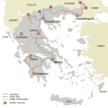
Greek railway network.svg 620 × 620; 524 KB
-
Map of Greece 1903 Thessaly.png 679 × 394; 735 KB
-
Map of Greece 1903.png 3,472 × 2,768; 15.57 MB
-
Network Chemin de Fer Jonction Salonique–Constantinople.png 3,011 × 1,344; 4.46 MB
-
OSE network.png 620 × 513; 29 KB
-
OSE.png 1,468 × 1,674; 3.45 MB
-
Proastiakospatra.png 695 × 293; 40 KB
-
Perivolaki – Nea Zichni railway line.png 1,437 × 722; 634 KB
-
Railkozaniamyntaio.png 576 × 512; 774 KB
-
Railway map of Greece.png 3,392 × 3,507; 828 KB
-
Railway map of South East Europe.png 5,405 × 5,290; 5.05 MB
-
Προαστιακός σιδηρόδρομος Fr.jpg 800 × 554; 805 KB


_Mountains%2C_M._Sultanitza%2C_Cengel_Dagh_and_Gornji_Poroj.jpg/120px-thumbnail.jpg)


