Category:Rail transport maps of Kent
Jump to navigation
Jump to search
Media in category "Rail transport maps of Kent"
The following 29 files are in this category, out of 29 total.
-
Hastings line.png 2,421 × 2,014; 3.41 MB
-
North Kent Line.png 2,298 × 1,158; 2.41 MB
-
Ashford to Ramsgate line.png 2,113 × 1,694; 1.96 MB
-
Bexleyheath line.png 3,404 × 1,509; 4.03 MB
-
Bowaters Paper Railway-old map.jpg 223 × 435; 80 KB
-
BowatersMap.png 1,011 × 913; 64 KB
-
Carte du comté de Kent-Mc Corquodale-1.jpg 3,228 × 2,076; 3.08 MB
-
Chatham main line.png 3,042 × 1,442; 3.34 MB
-
Dartford Loop Line.png 3,591 × 1,294; 3.11 MB
-
Elham.png 1,043 × 1,271; 65 KB
-
Hastings Kent Railways.svg 1,839 × 1,207; 923 KB
-
High Speed 1 CTRL.png 2,440 × 1,545; 2.58 MB
-
HS1 map.png 1,118 × 700; 759 KB
-
HS4Air.png 1,118 × 700; 764 KB
-
Kent Coast line.png 1,778 × 1,892; 1.34 MB
-
Kent Railways.svg 1,839 × 1,207; 125 KB
-
Maidstone line.png 2,514 × 1,503; 2.87 MB
-
Marshlink line.png 2,194 × 1,725; 2.01 MB
-
Medway Valley line.png 1,362 × 1,701; 1.56 MB
-
Ramsgate rail lines.png 1,024 × 768; 67 KB
-
Redhill–Tonbridge line.png 2,340 × 1,527; 2.92 MB
-
Sandwich kent map1945.jpg 894 × 700; 442 KB
-
SECR 1912 from A&C Black.jpg 1,024 × 706; 173 KB
-
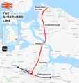
Sheerness line.png 1,798 × 1,884; 1.45 MB
-
South Eastern main line.png 3,011 × 1,805; 4.42 MB
-
Southeastern network diagram.jpg 14,596 × 5,935; 25.61 MB
-
Southeastern network map.svg 1,500 × 650; 293 KB
-
Southeastern network.svg 2,761 × 1,849; 937 KB
-
Southeastern route diagram.pdf 2,479 × 1,770; 128 KB


