Category:Rail transport maps of Leicestershire
Jump to navigation
Jump to search
Media in category "Rail transport maps of Leicestershire"
The following 11 files are in this category, out of 11 total.
-
B'ham-Peterborough Line Map.png 1,324 × 527; 954 KB
-
Birmingham–Peterborough line.png 2,647 × 1,485; 3.17 MB
-
CliffeHillMineralRailwayMap.png 615 × 467; 25 KB
-
Leicester–Burton upon Trent line.png 1,535 × 1,225; 1.47 MB
-
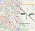
Loughborough Gap.png 750 × 661; 725 KB
-
Mcrmap.jpg 400 × 886; 31 KB
-
Syston - Peterborough 1846.png 1,587 × 826; 85 KB
-
Syston to Peterborough 1848.png 1,587 × 826; 93 KB
-
Syston to Peterborough1893.png 1,587 × 826; 153 KB
-
Syston to Peterbrough 1879.png 1,587 × 826; 145 KB
-
Zouch railway.png 1,063 × 1,190; 112 KB


