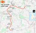
Category:Rail transport maps of London
Jump to navigation
Jump to search
Subcategories
This category has the following 10 subcategories, out of 10 total.
C
D
- Docklands Light Railway maps (10 F)
E
- Elizabeth line maps (26 F)
H
O
- London Overground maps (45 F)
R
- London RJD 1914 (25 F)
T
U
Media in category "Rail transport maps of London"
The following 125 files are in this category, out of 125 total.
-
Epsom Downs Branch.png 1,669 × 1,196; 1.22 MB
-
London–Aylesbury line.png 2,357 × 1,686; 3.52 MB
-
New Guildford line.png 1,634 × 1,514; 2.69 MB
-
North Kent Line.png 2,298 × 1,158; 2.41 MB
-
156 of 'Pitman's Commercial Geography of the World' (11248987925).jpg 1,936 × 1,325; 594 KB
-
16 of '(Cook's Handbook for London. With two maps.)' (11124681785).jpg 4,597 × 3,309; 3.29 MB
-
16 of '(Cook's Handbook for London. With two maps.)' (11129413205).jpg 4,711 × 3,369; 3.39 MB
-
16 of '(Cook's Handbook for London. With two maps.)' (11191924616).jpg 3,213 × 2,355; 2.17 MB
-
16 of '(Cook's Handbook for London. With two maps.)' (11245303263).jpg 3,217 × 2,479; 2.55 MB
-
Image taken from page 1091 of 'Old and New London, etc' (11289117765).jpg 1,822 × 981; 374 KB
-
LONDON ILLUSTR(1877) p6.023 DISTRICT RAILWAY.jpg 2,604 × 1,903; 3.95 MB
-
LONDON ILLUSTR(1878) p7.157 DISTRICT RAILWAY.jpg 3,109 × 2,056; 3.92 MB
-
LONDON ILLUSTR(1880) p9.127 DISTRICT RAILWAY.jpg 3,131 × 2,009; 4.27 MB
-
DISTRICT(1888) p027 - District Railway County Map.jpg 1,981 × 2,492; 1.2 MB
-
20 of '(Cook's Handbook for London. With two maps.)' (11150172385).jpg 5,308 × 3,398; 3.97 MB
-
20 of '(Cook's Handbook for London. With two maps.)' (11199079613).jpg 3,120 × 2,421; 2.22 MB
-
20 of '(Cook's Handbook for London. With two maps.)' (11214050705).jpg 3,202 × 2,505; 2.54 MB
-
20 of '(Cook's Handbook for London. With two maps.)' (11222381265).jpg 3,217 × 2,519; 2.28 MB
-
20 of '(Cook's Handbook for London. With two maps.)' (11229371474).jpg 3,233 × 2,492; 2.34 MB
-
Acton–Northolt line.png 2,243 × 1,302; 3.28 MB
-
Baedeker London 1907.jpg 6,328 × 5,100; 5.81 MB
-
Becontree railway system.gif 510 × 830; 55 KB
-
Brentford branch line.png 1,424 × 1,064; 1.13 MB
-
Brighton main line.png 1,797 × 2,374; 4.28 MB
-
British Rail London Terminal Group statioms.png 1,463 × 1,007; 36 KB
-
Brixton rail lines.png 2,179 × 616; 879 KB
-
Bromley north line connections.png 968 × 968; 838 KB
-
Bromley north line.png 667 × 667; 297 KB
-
Carte du réseau CFM, Maroc 1930.jpg 481 × 762; 138 KB
-
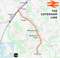
Caterham line.png 1,655 × 1,615; 1.5 MB
-
Catford Loop Line.png 2,727 × 1,905; 4.83 MB
-
Charing Cross Map 1860s-1870s.png 3,616 × 2,787; 9.3 MB
-
Charing Cross Map 1880s.png 3,616 × 2,787; 9.36 MB
-
Charing Cross Map 1890s.png 3,616 × 2,787; 9.3 MB
-
Charing Cross Map 1901.png 3,616 × 2,787; 9.33 MB
-
Charing Cross Map 1902.png 3,616 × 2,787; 9.28 MB
-
Chatham main line.png 3,042 × 1,442; 3.34 MB
-
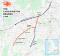
Chessington branch line.png 2,318 × 2,185; 3.49 MB
-
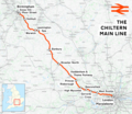
Chiltern Main Line map.png 866 × 761; 114 KB
-
Chiltern Main Line map.svg 866 × 772; 16 KB
-
Chiltern Main Line.png 2,098 × 1,822; 4.17 MB
-
Chingford branch line.png 2,091 × 2,400; 4.73 MB
-
City Widened Lines.svg 520 × 440; 35 KB
-
Crossrail2 Greater London.png 1,385 × 1,056; 448 KB
-
Crystal Palace line.png 2,594 × 1,951; 4.74 MB
-
Dartford Loop Line.png 3,591 × 1,294; 3.11 MB
-
Dollis Brook Viaduct map.png 503 × 301; 242 KB
-
East London line.png 2,106 × 2,834; 6.2 MB
-
East london railway 1915.jpg 277 × 450; 87 KB
-
Edgware stations, 1937.jpg 1,000 × 761; 640 KB
-
Euston High Speed 2.png 875 × 663; 978 KB
-
Extract of 1930 map of Edgware.png 627 × 416; 141 KB
-
Gospel Oak to Barking line.png 2,364 × 1,535; 3.79 MB
-
Great Eastern Main Line.png 1,936 × 1,905; 3.35 MB
-
Greater London rail frequency map.svg 595 × 466; 517 KB
-
Greenford branch line.png 1,841 × 1,270; 1.75 MB
-
Greenwich line.png 1,381 × 906; 1.13 MB
-
Greenwich Park branch line.png 1,040 × 772; 797 KB
-
Heathrow rail links.png 542 × 569; 50 KB
-
Hounslow Loop Line.png 2,840 × 1,567; 3.14 MB
-
HS1-HS2 Camden link.png 1,429 × 782; 414 KB
-
HS2 Euston tunnel.png 852 × 487; 211 KB
-
HS2 London route.png 1,875 × 760; 691 KB
-
Kensington - Richmond line 1869.gif 1,509 × 707; 76 KB
-
Kensington - Richmond line 1911.gif 1,509 × 707; 92 KB
-
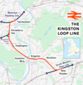
Kingston loop line.png 1,789 × 1,815; 2 MB
-
LB and SCRly map 204 (cropped).jpg 1,386 × 1,616; 1.35 MB
-
LB and SCRly map 204.jpg 1,500 × 1,972; 1.6 MB
-
Lea Valley lines.png 1,521 × 3,607; 5.11 MB
-
LHR Transport 01.png 600 × 291; 39 KB
-
London airport links summary.svg 1,052 × 744; 54 KB
-
London airport links.png 1,092 × 755; 155 KB
-
London airports rail.png 965 × 1,051; 1.53 MB
-
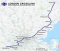
London Crosslink.png 2,353 × 1,992; 5.05 MB
-
London Midland Express.svg 459 × 255; 13 KB
-
London Post Office Railway Map.jpg 1,033 × 722; 119 KB
-
London Power Tunnels Phase 1.png 3,383 × 3,292; 6.29 MB
-
London Railway Network.jpg 500 × 375; 166 KB
-
LSWR Suburban 1869.gif 1,374 × 1,070; 90 KB
-
Maiden-lane-station.png 239 × 192; 62 KB
-
Major railway stations of London map.svg 1,198 × 835; 1.9 MB
-
Mid-Kent line.png 2,008 × 2,611; 4.21 MB
-
N&SWJR 1853.gif 1,069 × 1,141; 84 KB
-
N&SWJR 1862.gif 1,070 × 1,124; 87 KB
-
Neasden Junction.png 256 × 512; 44 KB
-
Netzplan S-Bahn London 2019.png 4,579 × 5,540; 2.9 MB
-
North London line.png 3,345 × 2,003; 7.11 MB
-
North-london-line.svg 770 × 438; 28 KB
-
Northern City Line.png 1,464 × 1,644; 2.37 MB
-
Northlondon.png 1,332 × 737; 29 KB
-
Oxted line.png 1,552 × 1,707; 2.6 MB
-
Railway map central London 1899.gif 1,054 × 749; 293 KB
-
Railway Map of Central London 1899.png 1,054 × 749; 804 KB
-
Railway Map of Central London, 1915.jpg 4,608 × 3,456; 5.05 MB
-
Railway stations, lines and termini in central London.png 982 × 673; 552 KB
-
Romford–Upminster line.png 1,788 × 1,266; 1.27 MB
-
S E London railways 1840.jpg 900 × 638; 159 KB
-
S england railways 1840.jpg 800 × 371; 88 KB
-
Shepperton branch line.png 2,239 × 1,416; 2.24 MB
-
South Eastern main line.png 3,011 × 1,805; 4.42 MB
-
South London line future services full.png 1,344 × 1,788; 122 KB
-
South london line future.png 1,308 × 928; 92 KB
-
South London line.png 2,531 × 1,593; 4.25 MB
-
South Western Main Line.png 2,726 × 1,844; 4.53 MB
-
Southbury Loop.png 1,455 × 1,869; 1.75 MB
-
Southern Metro vector map (2016).jpg 627 × 642; 82 KB
-
Stanmore branch line map.jpg 774 × 932; 270 KB
-
Station sign - Essex Road - 16 March 2017.jpg 4,592 × 3,448; 7.71 MB
-
Stratford International station MMB 04.jpg 3,792 × 2,568; 2.34 MB
-
Superlink detailed route map large3.svg 1,163 × 703; 11 KB
-
Sutton Loop Line.png 2,035 × 1,848; 3 MB
-
Tattenham Corner line.png 2,184 × 1,418; 1.76 MB
-
The Circle Routes of Victorian London.png 2,029 × 1,787; 203 KB
-
Track diagram London Bridge.png 3,516 × 1,744; 460 KB
-
Track diagram London Bridge2.png 3,516 × 1,744; 460 KB
-
Urban Transport and Morphology - London.png 4,558 × 4,204; 1.01 MB
-
Uxbridge-vs.png 1,031 × 1,251; 56 KB
-
Waterloo–Reading line.png 2,391 × 1,368; 3.36 MB
-
Watford DC line.png 2,455 × 1,858; 4.83 MB
-
West Anglia Main Line.png 1,594 × 2,375; 3.35 MB
-
West End Lane.jpg 590 × 494; 58 KB
-
West London line.png 1,998 × 1,726; 3.42 MB


.jpg/120px-156_of_%27Pitman%27s_Commercial_Geography_of_the_World%27_(11248987925).jpg)
%27_(11124681785).jpg/120px-16_of_%27(Cook%27s_Handbook_for_London._With_two_maps.)%27_(11124681785).jpg)
%27_(11129413205).jpg/120px-16_of_%27(Cook%27s_Handbook_for_London._With_two_maps.)%27_(11129413205).jpg)
%27_(11191924616).jpg/120px-16_of_%27(Cook%27s_Handbook_for_London._With_two_maps.)%27_(11191924616).jpg)
%27_(11245303263).jpg/120px-16_of_%27(Cook%27s_Handbook_for_London._With_two_maps.)%27_(11245303263).jpg)
.jpg/120px-Image_taken_from_page_1091_of_%27Old_and_New_London%2C_etc%27_(11289117765).jpg)
_p6.023_DISTRICT_RAILWAY.jpg/120px-LONDON_ILLUSTR(1877)_p6.023_DISTRICT_RAILWAY.jpg)
_p7.157_DISTRICT_RAILWAY.jpg/120px-LONDON_ILLUSTR(1878)_p7.157_DISTRICT_RAILWAY.jpg)
_p9.127_DISTRICT_RAILWAY.jpg/120px-LONDON_ILLUSTR(1880)_p9.127_DISTRICT_RAILWAY.jpg)
_p027_-_District_Railway_County_Map.jpg/95px-DISTRICT(1888)_p027_-_District_Railway_County_Map.jpg)
%27_(11150172385).jpg/120px-20_of_%27(Cook%27s_Handbook_for_London._With_two_maps.)%27_(11150172385).jpg)
%27_(11199079613).jpg/120px-20_of_%27(Cook%27s_Handbook_for_London._With_two_maps.)%27_(11199079613).jpg)
%27_(11214050705).jpg/120px-20_of_%27(Cook%27s_Handbook_for_London._With_two_maps.)%27_(11214050705).jpg)
%27_(11222381265).jpg/120px-20_of_%27(Cook%27s_Handbook_for_London._With_two_maps.)%27_(11222381265).jpg)
%27_(11229371474).jpg/120px-20_of_%27(Cook%27s_Handbook_for_London._With_two_maps.)%27_(11229371474).jpg)







.jpg/120px-Der_Weltverkehr_und_seine_Mittel._10._Aufl._1913_-_Beilage_01_Lageplan_Eisenbahnlinien_London_(14757176891).jpg)


.jpg/120px-Image_taken_from_page_1097_of_%27Old_%26_New_London._By_W._Thornbury_and_Edward_Walford._Illustrated%27_(11298668543).jpg)


.jpg/103px-LB_and_SCRly_map_204_(cropped).jpg)






.jpg/117px-Southern_Metro_vector_map_(2016).jpg)


