Category:Rail transport maps of North Yorkshire
Jump to navigation
Jump to search
Subcategories
This category has only the following subcategory.
Media in category "Rail transport maps of North Yorkshire"
The following 23 files are in this category, out of 23 total.
-
Battersbystationlayout.png 835 × 485; 18 KB
-
Battersbystationlayout.svg 840 × 468; 6 KB
-
British Rail York to Leeds via Harrogate diagram map.png 785 × 1,607; 95 KB
-
Cleveland Railway route 1863.jpg 856 × 357; 191 KB
-
Dearne Valley line.png 4,869 × 6,762; 14.01 MB
-
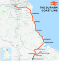
Durham Coast Line.png 1,481 × 1,550; 1.42 MB
-
Esk line tile map.jpg 1,408 × 1,056; 216 KB
-
Esk Valley line.png 2,585 × 1,557; 1.81 MB
-
Knottingley - Shaftholme Line.png 3,796 × 3,434; 4.17 MB
-
Leeds&bdfd1849.png 1,526 × 864; 116 KB
-
Leeds–Morecambe line.png 2,768 × 1,524; 2.62 MB
-
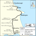
MaltonDriffieldRailwayRoute.png 960 × 720; 14 KB
-
North Bay Railway Map.jpg 628 × 1,234; 82 KB
-
North yorkshire moors railway map.gif 1,198 × 888; 73 KB
-
Northallerton–Eaglescliffe line.png 1,262 × 1,025; 801 KB
-
Pontefract line.png 5,234 × 3,587; 7.59 MB
-
Selby line.png 8,227 × 4,338; 12.92 MB
-
Settle–Carlisle line.png 1,633 × 1,421; 1.87 MB
-
Tees Valley line.png 3,122 × 1,481; 2.28 MB
-
YCLmap.png 763 × 783; 135 KB
-
York-Scarborough Railway.png 1,500 × 1,276; 543 KB
-
York–Scarborough line.png 4,468 × 3,377; 5.95 MB


