Category:Rail transport maps of Slovenia
Jump to navigation
Jump to search
Countries of Europe: Armenia‡ · Austria · Azerbaijan‡ · Belarus · Belgium · Bosnia and Herzegovina · Bulgaria · Croatia · Czech Republic · Denmark · Estonia · Finland · France‡ · Georgia‡ · Germany · Greece · Hungary · Republic of Ireland · Italy · Kazakhstan‡ · Latvia · Liechtenstein · Lithuania · Luxembourg · Moldova · Monaco · Montenegro · Netherlands‡ · North Macedonia · Norway · Poland · Portugal‡ · Romania · Russia‡ · San Marino · Serbia · Slovakia · Slovenia · Spain‡ · Sweden · Switzerland · Turkey‡ · Ukraine · United Kingdom · Vatican City
Specific status: Isle of Man – Limited recognition: Kosovo
‡: partly located in Europe
Specific status: Isle of Man – Limited recognition: Kosovo
‡: partly located in Europe
Slovenščina: Železniški prometni zemljevidi Slovenije.
Subcategories
This category has only the following subcategory.
Media in category "Rail transport maps of Slovenia"
The following 40 files are in this category, out of 40 total.
-
5th Congress railroad map.svg 1,171 × 1,059; 2.11 MB
-
Bahnline-Wiener-Neustadt-Triest-(1841).jpg 1,181 × 1,156; 1.12 MB
-
Cave del predil Log-pod Mangartom tunnel map.svg 836 × 811; 263 KB
-
Cividale-Kobarid railroad-map.svg 1,120 × 1,018; 13.08 MB
-
D-A-Wettbewerber-EVU.png 1,814 × 2,105; 1.22 MB
-
EC D.png 693 × 952; 90 KB
-
Karte Bahnstrecke Divača–Koper.png 2,212 × 1,844; 3.43 MB
-
Karte Bahnstrecke Jesenice–Trieste Campo Marzio.png 2,208 × 2,728; 5.1 MB
-
Karte Bahnstrecke Ljubljana–Dobova.png 2,498 × 1,330; 3.56 MB
-
Karte Bahnstrecke Ljubljana–Jesenice.png 1,688 × 1,602; 2.28 MB
-
Karte Bahnstrecke Ljubljana–Jesenice–Tarvisio.png 2,492 × 1,854; 3.65 MB
-
Karte Bahnstrecke Ljubljana–Kamnik Graben.png 1,736 × 2,126; 3.25 MB
-
Karte Bahnstrecke Ljubljana–Metlika–Karlovac.png 3,310 × 2,448; 6.86 MB
-
Karte Bahnstrecke Ormož–Hodoš.png 2,384 × 1,944; 5.18 MB
-
Karte Bahnstrecke Pivka–Rijeka.png 3,148 × 2,134; 4.93 MB
-
Karte der k.k. Staats-Eisenbahn zwischen Laibach und Triest (1850).jpg 7,029 × 4,516; 20.68 MB
-
Kranjska.jpg 1,252 × 944; 215 KB
-
Lageplan-der-Tauernbahn-(1921).jpg 930 × 1,417; 599 KB
-
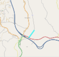
Ljubljana Pioneer Railway-map.svg 1,113 × 1,059; 1.73 MB
-
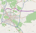
Ljubljana,Dravlje-Vodmat avoiding line-map.svg 1,115 × 1,058; 2.02 MB
-
Map Istrian railway.png 1,024 × 1,020; 235 KB
-
Map railroads Kingdom SHS.jpg 4,032 × 3,024; 5.9 MB
-
Mappa ferrovia Cividale-Caporetto.jpg 1,987 × 2,514; 1.36 MB
-
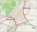
Mappa ferrovia Nova Gorica-Gorizia.svg 1,075 × 940; 9.99 MB
-
Parenzana - karta hr.jpg 450 × 370; 156 KB
-
Pesnica viaduct-map.svg 1,055 × 1,009; 1.12 MB
-
Map Pivka–Rijeka railway.png 1,024 × 914; 625 KB
-
Porečanka-zemljevid.jpg 450 × 370; 156 KB
-
Proga Ljubljana - Trst 1857.jpg 1,974 × 1,406; 349 KB
-
Railway map of Slovenia.png 1,571 × 1,011; 343 KB
-
Réseau ferré slovène.jpg 1,689 × 866; 133 KB
-
Slovenia regions map.png 1,552 × 1,057; 1.01 MB
-
Slovenian Railways 1918.jpg 2,000 × 1,495; 393 KB
-
Suedbahn 1899 Karte Muerzzuschlag-Marburg.jpg 4,035 × 1,980; 2.07 MB
-
Tivoli avoiding line-map.svg 1,131 × 1,029; 1.84 MB
-
Triest-als-Kartenbild-(1912).jpg 2,216 × 3,172; 4.88 MB
-
Uebersichtsplan der zweiten Verbindung mit Triest und der Pyhrnbahn (1901).jpg 926 × 1,421; 778 KB
-
Vizmarje-Crnuce-Laze line.svg 1,171 × 1,059; 2.11 MB
-
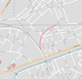
Vodmat avoiding line-ma.svg 1,066 × 1,019; 1.74 MB
-
Österreich-Ungarn 1898.jpg 3,470 × 2,631; 2.45 MB

.jpg/120px-Bahnline-Wiener-Neustadt-Triest-(1841).jpg)


.jpg/120px-Karte_der_k.k._Staats-Eisenbahn_zwischen_Laibach_und_Triest_(1850).jpg)

.jpg/79px-Lageplan-der-Tauernbahn-(1921).jpg)


.jpg/84px-Triest-als-Kartenbild-(1912).jpg)
.jpg/78px-Uebersichtsplan_der_zweiten_Verbindung_mit_Triest_und_der_Pyhrnbahn_(1901).jpg)


