Category:Rail transport maps of Somerset
Jump to navigation
Jump to search
Media in category "Rail transport maps of Somerset"
The following 16 files are in this category, out of 16 total.
-
Bristol and Bath Railway Path.svg 3,096 × 1,723; 46.23 MB
-
Bristol–Exeter line.png 2,351 × 2,403; 3.08 MB
-
Clevedon stations 1930.PNG 960 × 560; 62 KB
-
GWR map Somerset.jpg 960 × 768; 353 KB
-
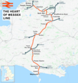
Heart of Wessex Line.png 2,382 × 2,537; 3.48 MB
-
Norton Fitzwarren crash (1940) diagram.svg 419 × 188; 30 KB
-
Portishead Branch Line.png 1,731 × 1,474; 2.04 MB
-
Reading–Taunton line.png 3,900 × 1,547; 4.37 MB
-
S&Y at Yeovil 1860.gif 951 × 955; 42 KB
-
South Somerset branch lines.png 760 × 580; 57 KB
-
Templecombe junction changes.png 960 × 640; 54 KB
-
Tn to Yeo 1857.gif 1,000 × 534; 35 KB
-
Wessex Main Line.png 2,630 × 2,022; 3.83 MB
-
Westbury and Frome lines.gif 4,609 × 3,278; 292 KB
-
Yeovil 1860 after LSW.gif 951 × 955; 45 KB
-
Yeovil railways.png 960 × 720; 46 KB


_diagram.svg/120px-Norton_Fitzwarren_crash_(1940)_diagram.svg.png)


