Category:Rail transport maps of the Netherlands
Jump to navigation
Jump to search
Countries of Europe: Armenia‡ · Austria · Azerbaijan‡ · Belarus · Belgium · Bosnia and Herzegovina · Bulgaria · Croatia · Czech Republic · Denmark · Estonia · Finland · France‡ · Georgia‡ · Germany · Greece · Hungary · Republic of Ireland · Italy · Kazakhstan‡ · Latvia · Liechtenstein · Lithuania · Luxembourg · Moldova · Monaco · Montenegro · Netherlands‡ · North Macedonia · Norway · Poland · Portugal‡ · Romania · Russia‡ · San Marino · Serbia · Slovakia · Slovenia · Spain‡ · Sweden · Switzerland · Turkey‡ · Ukraine · United Kingdom · Vatican City
Specific status: Isle of Man – Limited recognition: Kosovo
‡: partly located in Europe
Specific status: Isle of Man – Limited recognition: Kosovo
‡: partly located in Europe
Wikimedia list article | |||||
| Upload media | |||||
| Instance of | |||||
|---|---|---|---|---|---|
| |||||
Subcategories
This category has the following 6 subcategories, out of 6 total.
Media in category "Rail transport maps of the Netherlands"
The following 200 files are in this category, out of 263 total.
(previous page) (next page)-
AansluitingVanSpoorwegen RailwayJunction.svg 512 × 269; 3 KB
-
Achtergrond 2.jpg 5,592 × 6,422; 1.7 MB
-
Amsterdam - ligging van stations in 1936.jpg 334 × 239; 10 KB
-
Asdghnbddddddddddddddd.jpg 5,592 × 6,422; 786 KB
-
Avantislijn.png 1,055 × 768; 1.01 MB
-
Bahnstrecke Munster-Gronau.png 900 × 540; 135 KB
-
Bahnstrecke Oberhausen–Arnhem Karte.svg 1,381 × 1,275; 17.76 MB
-
Belslijntje.png 286 × 414; 6 KB
-
Besluit hoofdrailnet, Artikel 1 Bijlage 1.png 1,736 × 2,004; 1.83 MB
-
Brabantselijn.png 774 × 428; 9 KB
-
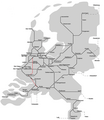
Castricum 1865 (26947399874).jpg 5,947 × 3,468; 1.54 MB
-
Castricum 1865 (26947400954).jpg 5,967 × 3,523; 2.49 MB
-
Castricum 1865 (27484705061).jpg 5,929 × 3,499; 1.7 MB
-
Castricum 1865 (27484705761).jpg 5,914 × 3,437; 2.13 MB
-
Castricum 1865 (27484707571).jpg 5,952 × 3,472; 2.03 MB
-
Centraalspoorweg.png 1,131 × 764; 104 KB
-
DB 2003 railway map.png 1,432 × 1,098; 2.16 MB
-
DB 2236 railway map.png 1,120 × 862; 1.83 MB
-
DB 2264 railway map.png 1,378 × 944; 1.25 MB
-
DB 2510 railway map.png 1,409 × 1,037; 1.87 MB
-
DB 2515 railway map.png 1,586 × 1,064; 2.81 MB
-
DB 2516 railway map.png 1,370 × 952; 1.32 MB
-
DB 2543 railway map.png 1,220 × 936; 1.44 MB
-
DB 2545 railway map.png 1,364 × 1,002; 1.94 MB
-
Den Haag - ligging van stations in 1936.jpg 236 × 264; 8 KB
-
Dokkumer lokaaltje.png 833 × 696; 29 KB
-
Drielandentrein.png 1,503 × 1,090; 2.51 MB
-
Duits Lijntje.png 710 × 726; 32 KB
-
Eiserner Rhein.png 10,588 × 1,855; 19.56 MB
-
Eisernerrhein-komplett.jpg 2,835 × 396; 168 KB
-
Euregiobahn01.png 1,201 × 708; 209 KB
-
Flevolijn.png 578 × 408; 15 KB
-
Fork Gaasperdammerweg Aansluiting.svg 512 × 128; 7 KB
-
Gooiboog.png 1,419 × 1,016; 475 KB
-
Haarlem-Amsterdam.png 3,307 × 1,921; 2.61 MB
-
Haarlemmermeerspoorlijnen.svg 2,478 × 2,302; 1,002 KB
-
Hanzelijn.PNG 886 × 389; 29 KB
-
Hemboog.png 1,204 × 967; 1.22 MB
-
Hoekselijn.png 538 × 318; 19 KB
-
Hollandsche Electrische-Spoorweg-Maatschappij 001.PNG 1,697 × 909; 123 KB
-
Hollandstrecke01.png 698 × 657; 162 KB
-
Hoofdroutembs.jpg 765 × 706; 134 KB
-
HSL4.png 1,611 × 1,107; 2.63 MB
-
IJmondlijn.png 678 × 498; 15 KB
-
IJzeren rijn compleet.jpg 2,835 × 396; 148 KB
-
IJzerenRijnNed.png 762 × 411; 42 KB
-
International trains map the Netherlands.svg 574 × 560; 270 KB
-
Kaart NOLS met route.jpg 407 × 567; 37 KB
-
Kaart pothoofd toen.PNG 573 × 732; 37 KB
-
Kaart van aangelegde spoorwegen GN14947.jpeg 2,083 × 1,993; 516 KB
-
Kaartnbds.jpg 1,144 × 1,036; 252 KB
-
Karte Eiserner Rhein.png 720 × 726; 55 KB
-
Karte Millionenlinie.png 718 × 726; 157 KB
-
Legenda pothoofd.PNG 327 × 462; 18 KB
-
Lelylijn hypothetisch tracé.svg 908 × 992; 2.25 MB
-
Lelylijn hypothetische tracés Potentieonderzoek 2020.svg 908 × 992; 2.28 MB
-
Lijn K.png 545 × 773; 43 KB
-
Lijnennet GOLS en KNLS.jpg 965 × 794; 122 KB
-
LijnH.png 774 × 490; 297 KB
-
Liniennetz Metro und RandstadRail.svg 748 × 591; 828 KB
-
Linksniederrheinische Strecke02.png 777 × 906; 89 KB
-
Lkkkkllllkkkkllll.jpg 5,592 × 6,422; 1.77 MB
-
Maaslijn.png 358 × 463; 38 KB
-
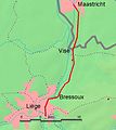
Maastalstrecke-liege-maastr.jpg 400 × 448; 21 KB
-
Mijnspoor Staatsmijn Maurits - Staatsmijn Hendrik op de kaart.png 1,924 × 954; 3.02 MB
-
Miljoenenlijn.PNG 457 × 423; 53 KB
-
Mk Rotterdam Metro Karte.png 1,868 × 1,437; 173 KB
-
Nachtreinen NL 2013.png 767 × 757; 62 KB
-
Niederlande und Betuwe 2.svg 744 × 1,052; 88 KB
-
Niederlande und Betuwe 3.svg 1,052 × 744; 97 KB
-
Niederlande und Betuwe 4 Arabic.jpg 1,218 × 896; 367 KB
-
Niederlande und Betuwe 4.svg 1,052 × 744; 97 KB
-
Niederlande und Betuwe 5.svg 1,052 × 744; 99 KB
-
Nijmegen-Kleef en Zevenaar-Kleef 1904.jpg 406 × 213; 19 KB
-
Noordelijke Nevenlijnen Groningen.png 5,393 × 2,521; 313 KB
-
Noordelijke nevenlijnen.png 250 × 158; 8 KB
-
Noordelijke Nevenlijnen.png 8,903 × 2,625; 419 KB
-
NoordelijkeNevenlijnen.JPG 1,039 × 569; 153 KB
-
Ontwerp NOLS 1890.jpg 800 × 1,200; 288 KB
-
Oosterspoorweg.png 774 × 403; 236 KB
-
Oude Lijn.png 774 × 635; 287 KB
-
Overzicht der onderlinge ligging van personenstations (1936).jpg 2,049 × 807; 188 KB
-
Overzicht tienminutentreinen (alleen Asd-Ehv).svg 1,052 × 744; 157 KB
-
Overzicht tienminutentreinen.svg 1,052 × 744; 154 KB
-
PBA train routes.svg 591 × 800; 11 KB
-
Post- und Eisenbahnkarte von Deutschland und den benachbarten Laendern.jpg 8,564 × 6,912; 21.14 MB
-
Proposal for a trainstation south of Amsterdam 1866.jpg 672 × 286; 74 KB
-
Raccordement Deelen.png 1,508 × 1,096; 1.36 MB
-
Raccordement Den Helder haven.png 998 × 738; 839 KB
-
Raccordement Hengelo AKZO.png 1,044 × 803; 598 KB
-
Raccordement Welschap.png 1,154 × 851; 1.5 MB
-
Railmap Zeeland.jpg 3,504 × 2,548; 657 KB
-
Randstad ZW.png 579 × 527; 157 KB
-
Randstadspoor osma.png 1,249 × 1,108; 2.37 MB
-
Randstadspoor.png 1,800 × 1,385; 263 KB
-
Randstadspoor.svg 595 × 465; 17 KB
-
Rhijnspoorweg.png 774 × 490; 262 KB
-
Rotterdam - ligging van stations in 1936.jpg 368 × 185; 8 KB
-
Route SVM.jpg 684 × 612; 274 KB
-
Sadfj;iaewrhb.jpg 5,592 × 6,422; 1.75 MB
-
Schematicmap.jpg 5,592 × 6,422; 1.56 MB
-
Schematische spoorkaart.svg 2,500 × 2,500; 180 KB
-
Schiphollijn.png 486 × 345; 20 KB
-
SGM 2010 Routes.jpg 640 × 522; 48 KB
-
Situatie Moerdijk.jpg 1,024 × 917; 275 KB
-
Spoor- en tramwegen in de kop van Noord-Holland rond 1920.svg 3,111 × 2,807; 114 KB
-
Spoorafstanden op objectvolgorde getekend.PNG 556 × 546; 24 KB
-
Spoorafstanden op volgorde van symbologie getekend.PNG 553 × 544; 24 KB
-
Spoorboog coevorden.png 1,220 × 905; 428 KB
-
Belgian Railway Line 12.png 1,596 × 1,121; 2.58 MB
-
Belgian Railway Line 18.png 1,519 × 1,042; 2.72 MB
-
Belgian Railway Line 20.png 1,480 × 1,066; 1.74 MB
-
Belgian Railway Line 29.png 1,412 × 1,016; 2.68 MB
-
Belgian Railway Line 40.png 1,441 × 1,050; 2.19 MB
-
Belgian Railway Line 54.png 1,558 × 1,102; 2.19 MB
-
Belgian Railway Line 55.png 1,465 × 1,010; 1.83 MB
-
Spoorlijn Aalsmeer - Amsterdam.png 1,596 × 1,244; 2.95 MB
-
Spoorlijn Aalsmeer - Haarlem.png 1,492 × 1,142; 2.7 MB
-
Spoorlijn Aalsmeer - Nieuwersluis-Loenen.png 1,408 × 1,064; 2.03 MB
-
Spoorlijn Alkmaar - Hoorn.png 1,307 × 898; 1.31 MB
-
Spoorlijn Almelo - Salzbergen.png 1,471 × 1,089; 2.05 MB
-
Spoorlijn Amsterdam - Elten.png 1,602 × 1,055; 3.04 MB
-
Spoorlijn Amsterdam - Rotterdam.png 1,424 × 1,067; 2.3 MB
-
Spoorlijn Amsterdam - Schiphol.png 1,358 × 1,030; 2.32 MB
-
Spoorlijn Amsterdam - Zutphen.png 1,366 × 968; 2.41 MB
-
Spoorlijn Apeldoorn - Deventer.png 1,667 × 1,184; 2.11 MB
-
Spoorlijn Apeldoorn - Zwolle.png 1,364 × 1,040; 1.96 MB
-
Spoorlijn Arnhem - Nijmegen.png 1,408 × 990; 1.71 MB
-
Spoorlijn Boekelo - Oldenzaal.png 1,324 × 990; 1.93 MB
-
Spoorlijn Bovenkerk - Uithoorn.png 1,363 × 996; 1.47 MB
-
Spoorlijn Breda - Eindhoven.png 1,292 × 923; 2.09 MB
-
Spoorlijn De Bilt - Zeist.png 1,093 × 839; 1.21 MB
-
Spoorlijn Den Dolder - Baarn.png 1,343 × 960; 1.51 MB
-
Spoorlijn Den Dolder-Baarn.PNG 1,218 × 817; 56 KB
-
Spoorlijn Deventer - Almelo.png 1,348 × 929; 1.75 MB
-
Spoorlijn Deventer - Ommen.png 1,244 × 881; 1.58 MB
-
Spoorlijn Dieren - Apeldoorn.png 1,572 × 1,171; 1.94 MB
-
Spoorlijn Doetinchem - Hengelo.png 1,146 × 836; 1.57 MB
-
Spoorlijn Eindhoven - Weert.png 1,299 × 929; 1.84 MB
-
Spoorlijn Elst - Dordrecht.png 1,383 × 965; 2.43 MB
-
Spoorlijn Enschede - Ahaus.png 1,329 × 985; 1.33 MB
-
Spoorlijn Gasselternijveen - Assen.png 1,265 × 873; 1.08 MB
-
Spoorlijn Glanerbrug - Losser.png 1,364 × 1,041; 1.08 MB
-
Spoorlijn Gouda - Alphen aan den Rijn.png 1,154 × 870; 1.27 MB
-
Spoorlijn Gouda - Den Haag.png 1,629 × 1,138; 2.65 MB
-
Spoorlijn Groningen - Delfzijl.png 1,345 × 956; 1.34 MB
-
Spoorlijn Groningen - Weiwerd.png 1,373 × 1,004; 1.43 MB
-
Spoorlijn Haarlem - Uitgeest.png 1,296 × 936; 1.34 MB
-
Spoorlijn Haarlem - Zandvoort.png 1,535 × 1,110; 1.86 MB
-
Spoorlijn Harmelen - Breukelen.png 1,422 × 1,040; 1.63 MB
-
Spoorlijn Harmelen-Breukelen.png 797 × 613; 26 KB
-
Spoorlijn Hattem - Kampen.png 1,335 × 982; 1.24 MB
-
Spoorlijn 's-Heer Arendskerke - Vlissingen Sloehaven.png 1,240 × 945; 835 KB
-
Spoorlijn heerlen-schin op geul.png 1,283 × 924; 1.1 MB
-
Spoorlijn Hilversum - Utrecht.png 1,419 × 1,083; 2.27 MB
-
Spoorlijn Hoofddorp - Leiden.png 1,475 × 1,095; 2.02 MB
-
Spoorlijn Hoorn - Medemblik.png 1,288 × 914; 1.14 MB
-
Spoorlijn Kesteren - Amersfoort.png 1,624 × 1,212; 2.83 MB
-
Spoorlijn Kijfhoek - Maasvlakte.png 1,364 × 930; 1.61 MB
-
Spoorlijn Kijfhoek - Zevenaar.png 1,734 × 1,076; 3.73 MB
-
Spoorlijn Lage Zwaluwe - 's-Hertogenbosch.png 1,345 × 963; 1.93 MB
-
Spoorlijn Lage Zwaluwe - Moerdijk.png 1,160 × 900; 679 KB
-
Spoorlijn Leeuwarden - Anjum.png 1,482 × 1,122; 1.76 MB
-
Spoorlijn Leeuwarden - Stavoren.png 1,192 × 891; 1.16 MB
-
Spoorlijn Leidschendam aansluiting - Zoetermeer.png 1,226 × 907; 1.51 MB
-
Spoorlijn Lelystad - Hattemerbroek aansluiting.png 1,515 × 1,051; 2 MB
-
Spoorlijn Lewedorp - Vlissingen Sloehaven.png 1,248 × 941; 853 KB
-
Spoorlijn maastricht venlo.png 1,536 × 1,138; 2.74 MB
-
Spoorlijn Mariënberg - Almelo.png 1,528 × 1,087; 1.77 MB
-
Spoorlijn Neede - Hellendoorn.png 1,425 × 1,051; 2.38 MB
-
Spoorlijn Nijkerk - Ede-Wageningen.png 1,323 × 951; 1.92 MB
-
Spoorlijn Nijmegen - Kleve.png 1,313 × 922; 1.28 MB
-
Spoorlijn Nijmegen - Venlo.png 1,458 × 1,087; 2.36 MB
-
Spoorlijn Roosendaal - Breda.png 1,397 × 1,075; 1.85 MB
-
Spoorlijn Rotterdam - Scheveningen.png 1,426 × 1,070; 2.24 MB
-
Spoorlijn Santpoort Noord - IJmuiden.png 1,187 × 947; 998 KB
-
Spoorlijn Sauwerd - Eemshaven.png 1,412 × 998; 1.1 MB
-
Spoorlijn schaesberg simpelveld.png 1,364 × 958; 1.75 MB
-
Spoorlijn Schiedam - Hoek van Holland.png 1,310 × 933; 1.51 MB
-
Spoorlijn Sint Pancras - Broek op Langedijk.png 1,244 × 932; 1.06 MB
-
Spoorlijn Stadskanaal - Ter Apel.png 1,449 × 1,132; 1.29 MB
-
Spoorlijn Stadskanaal - Zuidbroek.png 1,334 × 978; 1.35 MB
-
Spoorlijn Stiens - Harlingen.png 1,536 × 1,078; 1.25 MB
-
Spoorlijn Tilburg - Nijmegen.png 1,322 × 831; 1.88 MB
-
Spoorlijn Tzummarum - Franeker.png 1,422 × 1,030; 951 KB



.jpg/120px-Castricum_1865_(26947399874).jpg)
.jpg/120px-Castricum_1865_(26947400954).jpg)
.jpg/120px-Castricum_1865_(27484705061).jpg)
.jpg/120px-Castricum_1865_(27484705761).jpg)
.jpg/120px-Castricum_1865_(27484707571).jpg)


_-_von_Rudolf_Gross..._-_btv1b84683875.jpg/120px-Eisenbahnkarte_der_vollendeten..._und_projectirten_Bahnen_in_Deutschland%2C_Belgien%2C_Holland..._(2._Auflage)_-_von_Rudolf_Gross..._-_btv1b84683875.jpg)









.svg/120px-Overzicht_tienminutentreinen_(alleen_Asd-Ehv).svg.png)


