Category:Rail transport maps of the West Midlands (county)
Jump to navigation
Jump to search
Media in category "Rail transport maps of the West Midlands (county)"
The following 39 files are in this category, out of 39 total.
-
1913MRdiagramBirmingham.jpg 1,000 × 1,233; 293 KB
-
B'ham-Peterborough Line Map.png 1,324 × 527; 954 KB
-
Birmingham & West Mids Passenger Railway Map (no Metro).svg 1,304 × 1,039; 298 KB
-
Birmingham & West Mids Passenger Railway Map.JPG 1,248 × 1,142; 472 KB
-
Birmingham & West Mids Passenger Railway Map.svg 1,374 × 1,056; 315 KB
-
Birmingham Cross-City Line.png 5,000 × 9,000; 368 KB
-
Birmingham rail map.png 1,380 × 1,241; 70 KB
-
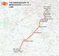
Birmingham to Worcester via Bromsgrove Line.png 2,275 × 2,160; 3.84 MB
-
Birmingham to Worcester via Kidderminster Line.png 2,275 × 2,160; 3.8 MB
-
Birmingham UK transport map.svg 2,760 × 2,481; 403 KB
-
Birmingham-Worcester rail routes.png 839 × 1,599; 76 KB
-
BirminghamLoop.svg 2,060 × 1,600; 51 KB
-
Birmingham–Peterborough line.png 2,647 × 1,485; 3.17 MB
-
Camp Hill Line.png 1,999 × 1,851; 3.11 MB
-
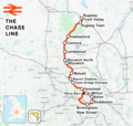
Chase line.png 1,277 × 1,208; 1.4 MB
-
Chiltern Main Line map.png 866 × 761; 114 KB
-
Chiltern Main Line map.svg 866 × 772; 16 KB
-
Chiltern Main Line.png 2,098 × 1,822; 4.17 MB
-
Coventry–Leamington line.png 1,668 × 1,521; 1.72 MB
-
Coventry–Nuneaton line.png 1,487 × 1,832; 1.95 MB
-
Cross-City Line Map (alt version).png 1,240 × 1,244; 1.5 MB
-
Cross-City Line.png 1,391 × 1,347; 1.87 MB
-
Midland at walsall.png 1,296 × 1,070; 119 KB
-
Monument Lane Station map w3200.jpg 3,200 × 1,891; 3.04 MB
-
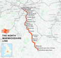
North Warwickshire line.png 1,184 × 1,130; 1.34 MB
-
NorthWarwickshireLine.jpg 1,423 × 1,815; 412 KB
-
Rugby–Birmingham–Stafford line.png 2,022 × 1,730; 3.15 MB
-
Snow Hill Lines.svg 512 × 419; 1.03 MB
-
SnowHillLines.png 1,700 × 1,200; 285 KB
-
Stourbridge Town branch line.png 1,188 × 797; 521 KB
-
Sutton Park line.png 1,988 × 1,418; 2.76 MB
-
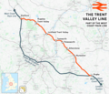
Trent Valley line.png 2,022 × 1,730; 3.15 MB
-
Walsall–Wolverhampton line.png 1,463 × 960; 1.55 MB
-
West Midlands and CrossCountry Network Map.svg 1,400 × 1,120; 262 KB
-
West Midlands Railway route map 2018.png 1,000 × 1,057; 498 KB
-
West Midlands Trains route map 2018 01.png 1,000 × 1,057; 408 KB
-
West Mids Metro and Rail Passenger Railway Map.svg 660 × 432; 315 KB
-
Wolverhampton–Shrewsbury line.png 2,653 × 1,770; 3.04 MB


.svg/120px-Birmingham_%26_West_Mids_Passenger_Railway_Map_(no_Metro).svg.png)







.png/120px-Cross-City_Line_Map_(alt_version).png)


