File:London Midland route map 2013.svg
Jump to navigation
Jump to search

Size of this PNG preview of this SVG file: 567 × 599 pixels. Other resolutions: 227 × 240 pixels | 454 × 480 pixels | 727 × 768 pixels | 969 × 1,024 pixels | 1,938 × 2,048 pixels | 1,000 × 1,057 pixels.
Original file (SVG file, nominally 1,000 × 1,057 pixels, file size: 1.17 MB)
Captions
Captions
Add a one-line explanation of what this file represents
Summary[edit]
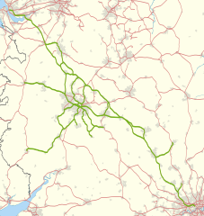
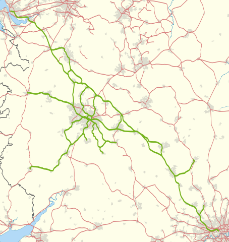
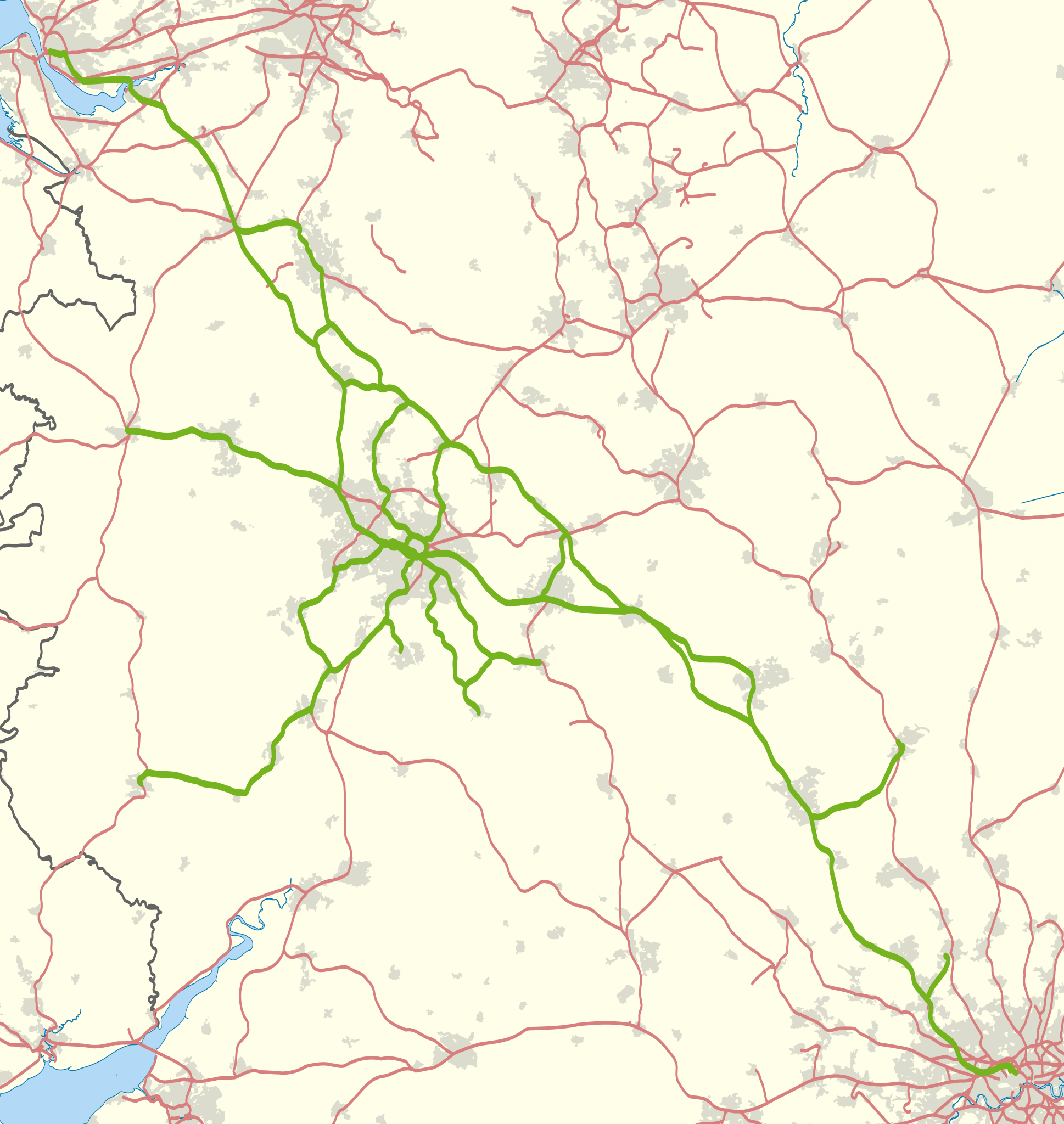
| Description | Map showing railway routes operated by London Midland in 2013. The background map shows the coastline and major urban areas. Equirectangular map projection on WGS 84 datum, with N/S stretched 160% |
| Date | |
| Source |
|
| Author | Nilfanion |
Licensing[edit]
I, the copyright holder of this work, hereby publish it under the following licenses:
This file is licensed under the Creative Commons Attribution-Share Alike 3.0 Unported license.
- You are free:
- to share – to copy, distribute and transmit the work
- to remix – to adapt the work
- Under the following conditions:
- attribution – You must give appropriate credit, provide a link to the license, and indicate if changes were made. You may do so in any reasonable manner, but not in any way that suggests the licensor endorses you or your use.
- share alike – If you remix, transform, or build upon the material, you must distribute your contributions under the same or compatible license as the original.

|
Permission is granted to copy, distribute and/or modify this document under the terms of the GNU Free Documentation License, Version 1.2 or any later version published by the Free Software Foundation; with no Invariant Sections, no Front-Cover Texts, and no Back-Cover Texts. A copy of the license is included in the section entitled GNU Free Documentation License. |
You may select the license of your choice.
File history
Click on a date/time to view the file as it appeared at that time.
| Date/Time | Thumbnail | Dimensions | User | Comment | |
|---|---|---|---|---|---|
| current | 23:50, 9 November 2013 | | 1,000 × 1,057 (1.17 MB) | Nilfanion (talk | contribs) | == Summary == {{Information |Description=Map showing railway routes operated by London Midland in 2013. The background map shows the coastline and major urban areas. Equirectangular map projection on WGS 84 datum, with N/S stretche... |
You cannot overwrite this file.
File usage on Commons
The following 2 pages use this file:
File usage on other wikis
The following other wikis use this file:
- Usage on en.wikipedia.org
- Usage on www.wikidata.org