Category:Rail transport maps of England
Jump to navigation
Jump to search
Subcategories
This category has the following 48 subcategories, out of 48 total.
B
C
- Rail transport maps of Cheshire (19 F)
- Rail transport maps of Cumbria (27 F)
D
E
H
- Rail transport maps of Hampshire (15 F)
K
- Rail transport maps of Kent (29 F)
L
M
N
O
R
- Rail transport maps of Rutland (11 F)
S
- Rail transport maps of Surrey (16 F)
T
W
Media in category "Rail transport maps of England"
The following 164 files are in this category, out of 164 total.
-
 1888 Rickmansworth-Aylesbury scheme.png 1,053 × 745; 182 KB
-
 Allington Chord schematic.svg 1,772 × 1,772; 177 KB
-
 Alston branch.png 1,081 × 1,372; 62 KB
-
 Avon & Glos Rly.gif 749 × 1,342; 97 KB
-
 B&T rly 1854.png 1,082 × 1,227; 91 KB
-
 B&T rly 1874.png 1,082 × 1,227; 92 KB
-
 B&T rly 1922.png 1,082 × 1,227; 111 KB
-
 Birkenhead Heritage Tramway - OpenStreetMap.png 1,280 × 512; 337 KB
-
 Birm bris rly.jpg 700 × 895; 61 KB
-
 Birmingham and Derby Junction Railway map.jpg 500 × 688; 33 KB
-
 BishCastle.png 1,495 × 649; 39 KB
-
 BLmap.png 870 × 521; 106 KB
-
 Boltonandprestonrly.png 1,066 × 1,116; 75 KB
-
 Bramptonrly1852.png 1,516 × 1,009; 72 KB
-
 Brandling.png 1,541 × 1,013; 118 KB
-
 Bristol area rail map.svg 1,058 × 597; 228 KB
-
 Bristol diamond junction diagram.png 612 × 529; 14 KB
-
 Britanico lineas de tren principal diagrama.PNG 450 × 600; 144 KB
-
 Britannique diagramme principale de chemin de fer lignes.PNG 450 × 600; 145 KB
-
 Britische Hauptlinien Eisenbahn-Diagramm Waverley Line.png 698 × 933; 303 KB
-
 Britische Hauptlinien Eisenbahn-Diagramm.PNG 449 × 600; 146 KB
-
 British Rail Borderlands Line diagram with interconnections.png 1,576 × 1,576; 150 KB
-
 British Rail Borderlands Line diagram with interconnections.svg 1,576 × 1,576; 4 KB
-
 Buxton Line map.png 696 × 648; 304 KB
-
 C2c route map 2010.svg 1,000 × 709; 301 KB
-
 Calsleep.png 325 × 361; 13 KB
-
 Chiltern Railways network.svg 2,027 × 1,550; 982 KB
-
 Chiltern Railways Off-Peak Map.png 945 × 1,280; 61 KB
-
 Chiltern Railways route map 2010.svg 1,000 × 764; 524 KB
-
 Chiltern Railways route map 2011.svg 1,000 × 764; 525 KB
-
 Citylinkmap2.svg 752 × 496; 30 KB
-
 Citylinkmap3.svg 1,230 × 600; 8 KB
-
 Cleveland Railway and its connections 1863.jpg 1,600 × 927; 348 KB
-
 CLmap.png 604 × 379; 63 KB
-
 Coleford rly.png 1,476 × 1,099; 76 KB
-
 Cross Country Route.png 1,547 × 2,132; 3.84 MB
-
 Cumbria railway final route.png 1,082 × 1,393; 193 KB
-
 Cumbria railway later proposals.png 1,082 × 1,393; 191 KB
-
 Derby Midland Railway.jpg 900 × 1,103; 141 KB
-
 DNS System Map.gif 2,632 × 3,854; 282 KB
-
 Dore Chinley.jpg 700 × 278; 30 KB
-
 East Coast Main Line inter-city services.svg 512 × 512; 320 KB
-
 East Glos Rly 1873.png 4,653 × 2,507; 235 KB
-
 East Midlands route map 2010.svg 1,002 × 1,046; 1.42 MB
-
 EastAngliaFranchise.svg 512 × 724; 1.51 MB
-
 Eaton hall railway.jpg 701 × 401; 47 KB
-
 Emt vector map.svg 492 × 942; 36 KB
-
 First Capital Connect route map 2010.svg 1,000 × 1,306; 926 KB
-
 First Great Western route map 2010.svg 1,425 × 966; 338 KB
-
 First Hull Trains route map 2010.svg 1,000 × 1,346; 1.14 MB
-
 GCR & Met Railways 1906.svg 334 × 493; 24 KB
-
 GCRmap1903.JPG 1,536 × 2,048; 1,023 KB
-
 GNWR Northern Map.svg 2,097 × 2,075; 30 KB
-
 Govia Thameslink Railway Map.svg 512 × 669; 491 KB
-
 Grand Central Railway route map 2010.svg 1,000 × 1,346; 1.61 MB
-
 Great Central Main Line map.png 891 × 1,014; 78 KB
-
 Great Way Round 1857.gif 6,834 × 3,154; 293 KB
-
 Great Way Round 1862.gif 6,834 × 3,154; 320 KB
-
 Great Way Round 1900.gif 6,834 × 3,154; 324 KB
-
 Great Way Round 1905.gif 6,834 × 3,154; 327 KB
-
 Great Way Round 1933.gif 6,834 × 3,154; 332 KB
-
 Great Western Main Line de.svg 1,999 × 831; 3.32 MB
-
 Great Western Main Line Map de.png 6,669 × 2,777; 2.52 MB
-
 Great Western Main Line map.png 2,861 × 994; 3.12 MB
-
 Great Western Railway network.svg 2,562 × 1,765; 1.04 MB
-
 Greater Bristol Metro proposed network map March 2012.svg 7,500 × 4,600; 47 KB
-
 GWR main line cut off routes.png 960 × 480; 66 KB
-
 GWR TOC Intercity Map Dec 09 2015.svg 1,875 × 744; 88 KB
-
 GWR TOC Intercity Map Dec 09 2015v2.svg 512 × 199; 36 KB
-
 Gwrmap.png 799 × 542; 95 KB
-
 Heathrow Southern Railway.png 1,250 × 1,134; 992 KB
-
 Henley branch.png 1,503 × 1,019; 68 KB
-
 HHay&BR1893.png 1,559 × 1,008; 90 KB
-
 HKBrailway.svg 925 × 450; 16 KB
-
 HolmfirthBranchLine.svg 355 × 682; 4 KB
-
 HS2 phase 2 Leeds.png 760 × 1,482; 1.71 MB
-
 Kendal and Windermere Railway.png 1,351 × 1,058; 49 KB
-
 L s map.jpg 2,437 × 1,729; 199 KB
-
 Lancaster and Carlisle Railway.png 823 × 1,477; 94 KB
-
 Lbscr1922.jpg 900 × 656; 95 KB
-
 Leedsrail.jpg 1,203 × 676; 85 KB
-
 London Midland route map 2010.svg 1,000 × 1,057; 1.16 MB
-
 London Midland route map 2013.svg 1,000 × 1,057; 1.17 MB
-
 London Northwestern Railway route map 2018.png 1,000 × 1,057; 498 KB
-
 London to Aylesbury Line.png 901 × 648; 37 KB
-
 London to Brighton Main Line locations.svg 1,065 × 3,235; 5.58 MB
-
 LSWR Suburban 1850.gif 1,374 × 1,070; 66 KB
-
-
.jpg) Map (47869354091).jpg 4,032 × 3,024; 2.29 MB
Map (47869354091).jpg 4,032 × 3,024; 2.29 MB
-
 Mapa99.png 1,047 × 387; 81 KB
-
 Marlborough and Sav 1933.gif 1,213 × 1,021; 67 KB
-
 Midland Main Line Map de.png 2,087 × 2,304; 1.91 MB
-
 Midland Main Line Map en.png 2,087 × 2,304; 1.9 MB
-
 Midland Main Line.png 5,114 × 5,385; 16.4 MB
-
 Midland Railway Langley Mill.jpg 300 × 385; 16 KB
-
 Midland to Manchester.jpg 800 × 502; 71 KB
-
 MR Rickmansworth-Chesham-LNWR extension scheme.png 1,053 × 745; 179 KB
-
 MSWJR 1881.gif 857 × 1,554; 97 KB
-
 National Express East Anglia route map 2010.svg 1,000 × 1,132; 493 KB
-
 National Express East Coast map.svg 370 × 675; 80 KB
-
 NDLmap.png 789 × 555; 116 KB
-
 Newc&Carl.png 1,544 × 470; 56 KB
-
 Newc&Carl1862.png 1,545 × 469; 70 KB
-
 Nickey Line map.png 1,157 × 1,034; 577 KB
-
 Night Riviera Train Map.svg 1,600 × 699; 837 KB
-
 Onenetwork.svg 625 × 525; 69 KB
-
 Os-el-whi.png 1,553 × 680; 58 KB
-
 P&DR map after Princetown Rly.gif 3,354 × 4,354; 391 KB
-
 P&DR map.gif 3,354 × 4,354; 267 KB
-
 PDLmap.png 824 × 729; 135 KB
-
 PenistoneLine.svg 600 × 600; 59 KB
-
 PLmap.png 1,069 × 508; 149 KB
-
 Pontop&ss1896.png 2,841 × 2,074; 282 KB
-
 Portishead rly map 1914.png 1,098 × 1,236; 1.5 MB
-
 Potteries Rail Map.png 960 × 720; 61 KB
-
 MSJAR map.jpg 1,280 × 1,416; 157 KB
-
 Railway history map, Truro railway station, Cornwall.jpg 3,531 × 2,307; 1.81 MB
-
 Railway lines in Staffordshire.svg 800 × 950; 47 KB
-
 RC&B 1862.gif 1,340 × 829; 55 KB
-
 RC&B 1873.gif 1,340 × 829; 56 KB
-
 RC&B 1888.gif 1,340 × 829; 56 KB
-
 Relief map of the Southern railway in the cafe at Eastleigh miniature railway.jpg 3,345 × 1,481; 611 KB
-
 Route of Wimbledon & Sutton Railway.png 1,170 × 2,644; 1.56 MB
-
 Rugby-Stafford rail routes.png 1,755 × 2,482; 201 KB
-
 S england railways 1840.jpg 800 × 371; 88 KB
-
 S&c vonal.JPG 621 × 764; 26 KB
-
 SERmap.jpg 2,190 × 1,101; 204 KB
-
 Severn and Solent Rail.svg 1,150 × 1,150; 62 KB
-
 Severnside Community Rail Partnership route map 2012.svg 742 × 791; 835 KB
-
 Shipley Windhill Comparison Chart.jpg 3,508 × 1,890; 521 KB
-
 SnailbeachDistrictRailways.png 741 × 958; 38 KB
-
 SnailbeachDistrictRailwaysMap.svg 765 × 990; 7 KB
-
 Soton and Dorch map 2013.gif 1,601 × 743; 85 KB
-
 Soton and Dorch map.gif 1,601 × 743; 66 KB
-
 South West Trains route map 2010.svg 999 × 758; 859 KB
-
 South Western Railway network.svg 2,761 × 1,849; 2.19 MB
-
 South Western Railway route map.svg 512 × 388; 427 KB
-
 Southeastern TOC route map 2010.svg 1,000 × 700; 411 KB
-
 Southern TOC route map 2010.svg 1,000 × 871; 800 KB
-
 Stanhope&tyne.png 2,841 × 2,074; 170 KB
-
 Superlink detailed route map large3.svg 1,163 × 703; 11 KB
-
 Tanfield.png 1,541 × 1,014; 69 KB
-
 Tees Valley Metro Proposed Stations.jpg 1,041 × 744; 132 KB
-
 Tees Valley Metro Route.png 2,481 × 1,309; 241 KB
-
_(14757884874).jpg) The Street railway journal (1904) (14757884874).jpg 1,250 × 1,982; 209 KB
The Street railway journal (1904) (14757884874).jpg 1,250 × 1,982; 209 KB
-
 The Victoria history of the County of Hertford Nickey Line.jpg 672 × 548; 170 KB
-
 Tile map Whitby Station.jpg 2,816 × 2,112; 2.82 MB
-
 Tiled Lancashire and Yorkshire Railway map.jpg 1,024 × 768; 683 KB
-
-
 Trans-Pennine Routes.svg 2,793 × 1,577; 4.72 MB
-
 Transport for Wales May 2022 Route Map.svg 512 × 559; 662 KB
-
 Trent Valley Railway, alternative routes through Shugborough.svg 1,196 × 789; 379 KB
-
 Varsity Line.svg 11,693 × 7,087; 245 KB
-
 Varsity line2.png 3,011 × 1,820; 36 KB
-
 VictoriaMural.jpg 2,816 × 1,725; 2.08 MB
-
 Virgin Trains East Coast services.svg 512 × 614; 195 KB
-
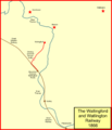 Wallingford branch.png 1,042 × 1,214; 53 KB
-
 Watford and Rickmansworth Railway.png 1,278 × 646; 563 KB
-
 Westbury routes.png 865 × 645; 52 KB
-
 Whitby Railway Station 2016 009 - North Eastern Railway.jpg 3,456 × 5,184; 11.7 MB
-
 Woodhead electric railway.png 1,700 × 600; 65 KB
-
 Wrex&elles.png 1,048 × 1,370; 71 KB
-
 WS&WR routes.gif 3,394 × 4,270; 403 KB
-
 Yeoveney Halt station.png 593 × 574; 999 KB