Category:Rail transport maps of the United Kingdom
Jump to navigation
Jump to search
Countries of Europe: Armenia‡ · Austria · Azerbaijan‡ · Belarus · Belgium · Bosnia and Herzegovina · Bulgaria · Croatia · Czech Republic · Denmark · Estonia · Finland · France‡ · Georgia‡ · Germany · Greece · Hungary · Republic of Ireland · Italy · Kazakhstan‡ · Latvia · Liechtenstein · Lithuania · Luxembourg · Moldova · Monaco · Montenegro · Netherlands‡ · North Macedonia · Norway · Poland · Portugal‡ · Romania · Russia‡ · San Marino · Serbia · Slovakia · Slovenia · Spain‡ · Sweden · Switzerland · Turkey‡ · Ukraine · United Kingdom · Vatican City
Specific status: Isle of Man – Limited recognition: Kosovo
‡: partly located in Europe
Specific status: Isle of Man – Limited recognition: Kosovo
‡: partly located in Europe
Wikimedia category | |||||
| Upload media | |||||
| Instance of | |||||
|---|---|---|---|---|---|
| Category combines topics | |||||
 | |||||
Subcategories
This category has the following 14 subcategories, out of 14 total.
Media in category "Rail transport maps of the United Kingdom"
The following 67 files are in this category, out of 67 total.
-
153 of 'Pitman's Commercial Geography of the World' (11247728904).jpg 1,312 × 1,942; 837 KB
-
33 of 'Guide to Ireland. (Second edition.) (With illustrations.)' (11251648746).jpg 2,807 × 2,422; 1.54 MB
-
A map of Routes managed by Govia in the United Kingdom.png 10,579 × 6,873; 3.5 MB
-
Barlick.png 732 × 552; 22 KB
-
Beeching2 clear.svg 1,480 × 2,436; 150 KB
-
Beeching2.svg 1,480 × 2,436; 182 KB
-
Bodleian Libraries, Binko's registered railway game. England.jpg 731 × 1,000; 104 KB
-
Britain and Ireland railway map 2023.pdf 945 × 1,081; 25.55 MB
-
British hlavni zeleznicnich trati diagram.PNG 449 × 600; 146 KB
-
British main lines railway diagram.png 2,464 × 3,508; 558 KB
-
British Railways regions (1951).svg 1,120 × 1,707; 265 KB
-
British Railways regions (ru).svg 1,050 × 1,600; 550 KB
-
Britse vernaamste lyne spoorweg diagram.PNG 450 × 600; 143 KB
-
Caledonian Sleeper.svg 579 × 800; 399 KB
-
Central Railway Route.svg 585 × 600; 81 KB
-
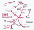
CrossCountry network.svg 1,847 × 1,631; 736 KB
-
CrossCountry route map.png 600 × 800; 128 KB
-
East Coast Main Line Map.png 1,096 × 1,511; 664 KB
-
East Coast Main Line.png 1,741 × 2,124; 1.83 MB
-
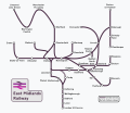
East Midlands Railway.svg 2,107 × 1,818; 590 KB
-
England and Wales rail network 2010.svg 1,108 × 1,345; 694 KB
-
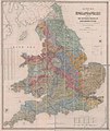
England Train network of Railways in 1919.jpg 1,092 × 1,222; 450 KB
-
Gospel Oak to Barking line.svg 750 × 288; 16 KB
-
Great Britain railway stations passengers 2018-19.svg 6,892 × 12,596; 3.93 MB
-
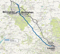
HS2 phase 1.png 1,024 × 920; 1.6 MB
-
Janis Oppliger 2016 (Unsplash).jpg 4,896 × 3,264; 2.36 MB
-
Karte der Longmoor Militäreisenbahn um 1965.png 555 × 703; 110 KB
-
LNER Route map May to December 2019.svg 512 × 878; 660 KB
-
LNER Route map.svg 512 × 878; 386 KB
-
LNWR & Caledonian Railway map.jpg 2,848 × 5,528; 16.88 MB
-
Map of Network Rail Strategic Routes in England and Wales 2014.svg 1,108 × 1,345; 791 KB
-
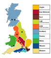
Network Rail Regions 18 November 2015.png 2,480 × 2,835; 430 KB
-
R-price-williams-map-1872.jpg 500 × 592; 154 KB
-
Race to the North-pathtext.svg 1,457 × 2,536; 333 KB
-
Race to the North.svg 1,457 × 2,536; 87 KB
-
Rail Map GB (RC).png 1,524 × 1,444; 273 KB
-
Railway Map of Great Britain, 1915.jpg 3,456 × 4,608; 4.99 MB
-
Railways in 1800, Great Britain. Wellcome L0002540.jpg 1,072 × 1,764; 344 KB
-
Rivers Canals and Railways of Great Britain 1831.jpg 3,976 × 5,104; 3.68 MB
-
Roell-1912 Karte der Britischen und Irischen Eisenbahnen.jpg 3,456 × 4,734; 1.77 MB
-
Route of the bullion train for the 1855 Great Gold Robbery.png 1,234 × 863; 1.25 MB
-
Thames Tunnel-route.png 2,168 × 3,998; 7.16 MB
-
Thameslink.svg 1,807 × 1,575; 1.45 MB
-
Timetableworld-snapshot-2020-11-14-12-17-55.jpg 1,362 × 1,615; 673 KB
-
TOCs.jpg 2,199 × 3,109; 808 KB
-
TransPennine Express.svg 1,949 × 1,594; 681 KB
-
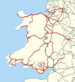
Transport for Wales May 2022 Route Map.svg 512 × 559; 662 KB
-
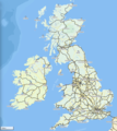
Uk ireland railway network.png 801 × 897; 468 KB
-
Uk outline map with ECML railway.PNG 600 × 800; 37 KB
-
Uk outline map with WCML railway.PNG 600 × 800; 40 KB
-
UK rail electrification by 2019.pdf 1,239 × 1,752; 1.06 MB
-
Ultraspeed.jpg 230 × 406; 55 KB
-
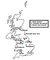
Urban rail in the UK.jpg 758 × 907; 58 KB
-
West Coast Main Line (edited).png 1,581 × 1,978; 1.58 MB
-
West Coast Main Line map.png 746 × 722; 403 KB
-
West Coast Main Line Map.png 3,649 × 4,995; 3.86 MB
-
West Coast Main Line service pattern diagram.svg 1,050 × 2,300; 31 KB
-
West Coast Main Line.png 1,581 × 1,978; 1.6 MB
-
Wrexham and Shropshire route map 2010.svg 1,000 × 850; 1.46 MB
.jpg)
%27_(11059436196).jpg)
%27_(11059186845).jpg)
_(with_illustrations.)%27_(11251648746).jpg)
.jpg)


.jpg)



.svg.png)
.svg.png)






%27_(11211019095).jpg)
.jpg)




.png)






.png)


